— CONTRIBUTE

Help us map Blue Corridors for Turtles and Important Marine Turtle Areas

BC4T invites you to collaborate and share data. Since February 2025 we’ve been receiving nesting, satellite telemetry and genetic data from collaborators worldwide to support ours and the mission of the IUCN-SSC MTSG. Whichever type you hold, here’s where it fits in.

Nesting Data

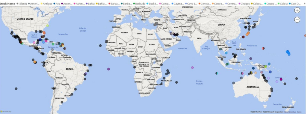
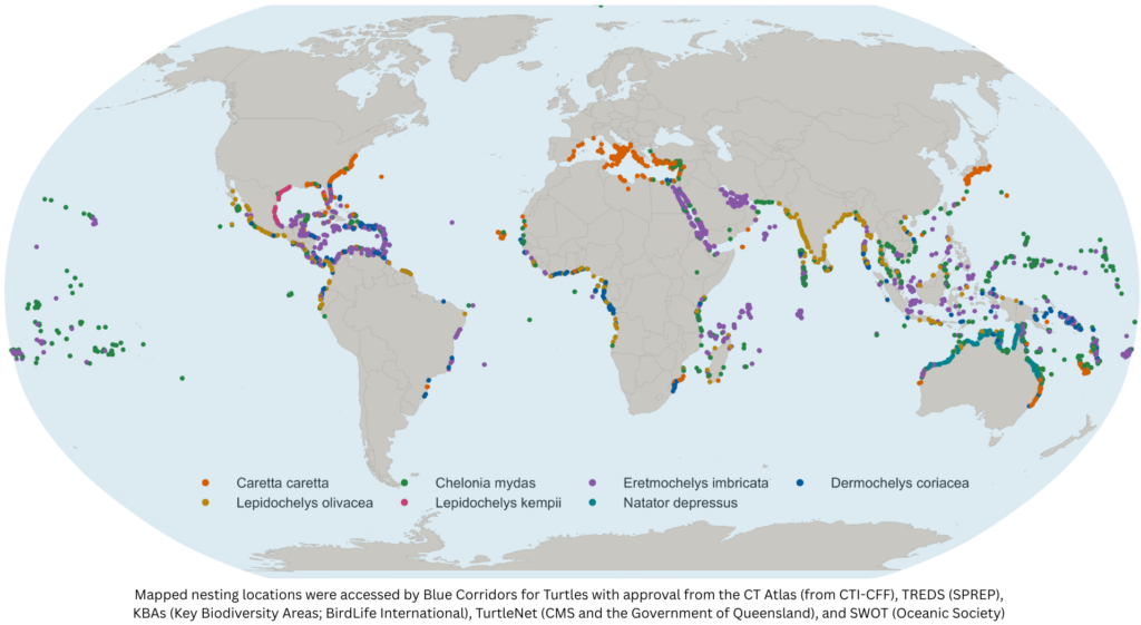
We invite information on the locations of nesting sites to produce a global map and connectivity baseline; please refer to this map to see sites that have already been mapped by collaborating platforms. If you know of a site that is missing, or see a site incorrectly mapped, please let us know.

Satellite Telemetry

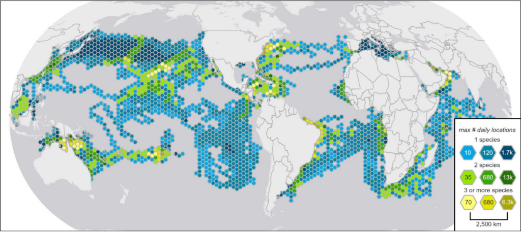
We invite raw satellite tracking location data for sea turtles with accompanying metadata. Metadata should meet BC4T’s minimum standards for telemetry data. A metadata template can be found here.

Genetic Data

We invite information from samples already analyzed (mtDNA or nuclear DNA), or stored and ready for analysis, with a focus on helping to delineate genetically distinct populations and connectivity between nesting and foraging areas. We invite you to provide your email address and basic information—not raw data—and our team members from ShellBank will contact you.

Via ShellBank

— How it works

From your dataset to the global map

Every dataset we receive — nesting, satellite telemetry, or genetic — moves through the same five-stage process.

1

Initial contact

We reach out via CLS accounts, listservs and professional networks, and introduce the project’s goals and terms of reference.

2

QAQC

Minimum data requirements are assessed, fields are reviewed and cleaned, and metadata is linked to locations.

3

Processing

Erroneous or on-land locations are removed, tracks are smoothed, and daily locations are estimated.

4

Follow Up

We follow up on missing metadata, technical questions, or anything that looks erroneous.

5

Completion & Analysis

Your dataset joins the combined geodatabase, ready for corridor and IMTA analysis — and we send it back as a final QAQC step.

How your data is used and credited

Contributing gives you real benefits: centralisation and cleaning by our expert analyst team, acknowledgement on every output we publish, including co-authorship within our consortium, and a seat at future regional IMTA workshops. Your data is stored securely and only shared with third parties when you authorise it, exactly as set out in our February 2025 terms of reference.
— Where your contributed data goes

What your submitted data becomes

Once processed, your data feeds directly into five outputs used across the project.

Cleaned & interoperable tracks

Finalised, QA/QC’d datasets ready for connectivity modelling and IMTA designation.

Derived movement metrics

Summaries like mean travel distance, seasonal site fidelity and corridor overlap, used for population risk assessment.

Integration with genetic & community data

Merged with ShellBank genetics and coastal community layers for multidimensional planning.

Gap identification

Spatial analysis of coverage gaps, especially high seas corridors and lesser-known foraging areas, to guide future deployments and efforts.

Open data products

Publicly shareable layers, subject to partner agreements, hosted on global marine spatial platforms.

Help us fill the gaps

Beyond data, we need funding and equipment (satellite transmitters, genetic sample kits, and field gear) to reach the communities and populations that need them most.